The best St Croix map for visitors combines three things: a clear road map for driving, a beach map for planning where to swim and snorkel, and an interactive map for navigation.
Most travelers use Google Maps for directions, a printable map as a backup, and a beach map to choose where to spend their time.
If you’re using this map to plan your trip, the most important decision is not just where things are – but where to stay on the island.
→ See the best areas to stay in St Croix and how location affects your experience.
Author note: We are full-time St Croix residents since 2012 and update this map guide monthly based on on-the-ground conditions, road changes, and beach access updates.
St Croix Map (USVI): Road, Beach, and Tourist Maps Explained
Use this page depending on your need:
• For driving directions → use the interactive map (download offline before arrival)
• For backup navigation → use the printable PDF road map
• For beach planning → use the beach map with snorkeling and swim spots
Quick links: Printable PDF road map | Beach map | Tourist map | Drive times | FAQ
- Do I Need a Passport for St Croix?
- St Croix Airport (STX) guide
- Best Beaches on St Croix
- Best Time to Visit St Croix
- Is St Croix safe?
- Do I need a car in St Croix?
- St Croix beachfront villas for couples
St Croix Maps Overview


How to read these maps and choose where to stay
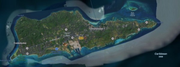
From the St Croix Google map, you can see the hilly terrain, lush green areas, and plenty of locations where beach meets beautiful turquoise water. St. Croix remains one of the least over-built islands in the Caribbean. There’s nothing like looking out your windows and seeing lush, green, undeveloped hills.
The printable map of St Croix (.pdf)) can be used a backup for directions and beach access roads. Print it, or save it to your phone. This is especially useful if your data signal drops while driving.
The Tourist Map of St Croix helps you get around the island and find interesting things to do.
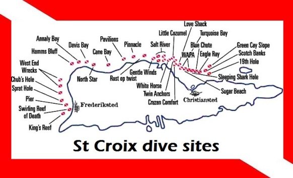
The St Croix Dive Site Map is a good guide for the finding the best scuba diving sites on the island. Learn more here: Best Dive Sites in St Croix.
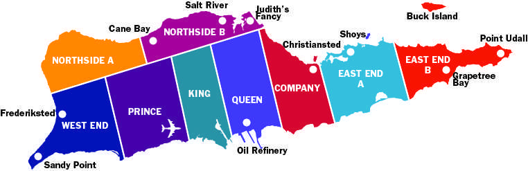
The St Croix quarters map is useful for people looking to buy property on St Croix. The island is divided into areas called quarters.
St Croix drive times (quick reference):
• Christiansted to Frederiksted: ~40 minutes
• Airport to Christiansted: ~20 minutes
• Airport to Frederiksted: ~25 minutes
• East End to West End: ~50 minutes
If you are visiting on a cruise day, plan your last stop close to the pier and leave buffer time for traffic.
→ Do you need a car in St Croix? (full guide)
Offline maps for St Croix (recommended)
Google Maps usually works well on St Croix, but you should download an offline map before you land. That gives you reliable navigation even if you lose signal on the west end or along the north shore.
- Open Google Maps on your phone.
- Search for “St Croix USVI”.
- Tap your profile icon (top right) and select Offline maps.
- Tap Select your own map and drag the box to cover all of St Croix.
- Tap Download.
Optional backup: install an offline map app that uses OpenStreetMap data, then download “St Croix” over Wi-Fi.
Other St Croix maps & navigation Resources
High-resolution satellite map
Here’s a nice satellite map of St Croix from Satellite.pro:
Map of Christiansted
Christiansted is the main town on the island, offering many attractions like:
- Christiansted boardwalk
- St Croix seaplane area
- Fort Christiansvaern
- Government House St Croix
- Hotel on the Cay
- Christiansted harbor
- D. Hamilton Jackson Park
- Scale House
→ See why Christiansted is one of the most popular areas to stay in St Croix
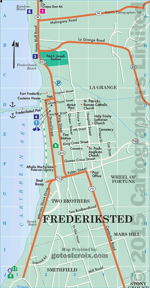
Map of Frederiksted
Fredericksted is located on St Croix’s west end and is know for the best sunsets. Places of interest include:
- Rhythms on Rainbow Beach
- Paradise Beach
- Frederiksted Pier
- Fort Frederik
- Strand Street
- St Patrick’s Catholic Church
- Custom’s House
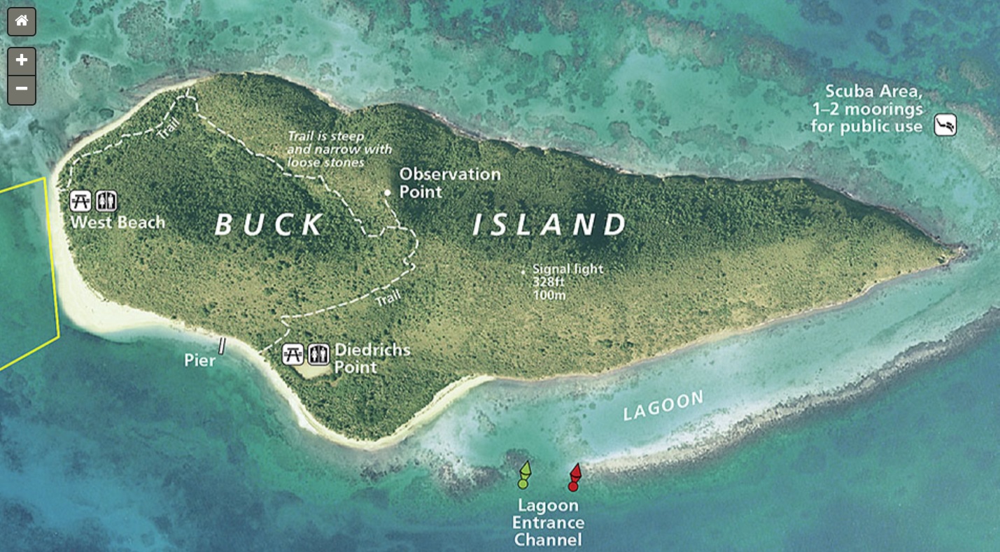
Map of Buck Island in St Croix
Buck Island St Croix should be on every St Croix visitor’s bucket list for 2026! It’s a protected natural park sanctuary, offering one of the purest natural beach experiences you will find anywhere. Conveniently, you can access the full map of Buck Island in St Croix here , provided by the National Park Services website. In addition, there is also an amazing underwater trail for snorkeling, plus Turtle Beach on Buck Island is one of the most pristine beaches you’ll find anywhere. Read more about Buck Island St Croix here (pdf).
Boat access is restricted and a number of licensed companies provide day trips to and from the island. It’s a beautiful 15-20 minute ride over to the island.
Good web resources for maps of St Croix
Here are some of our favorite (and free) resources on the web for finding good maps of our favorite island. Many are satellite based, and some resources even allow you to build your own St Croix maps with just a little effort.
GPS Visualizer: create your custom St Croix map
OpenHistoricalMap: shows a time-based map of the Virgin Islands
WikiMapia: an open-source St Croix map
MapQuest: a good map of St Croix services available in the the US Virgin Island
ACME Mapper: build your own map of Saint Croix here
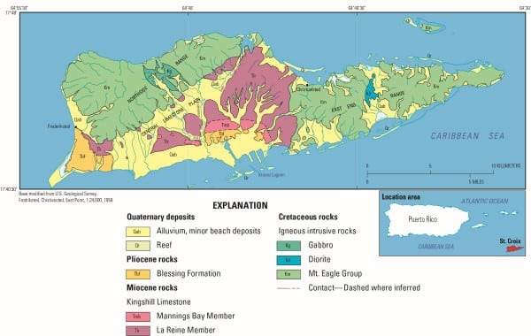
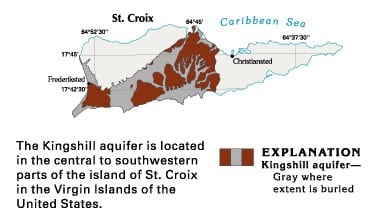
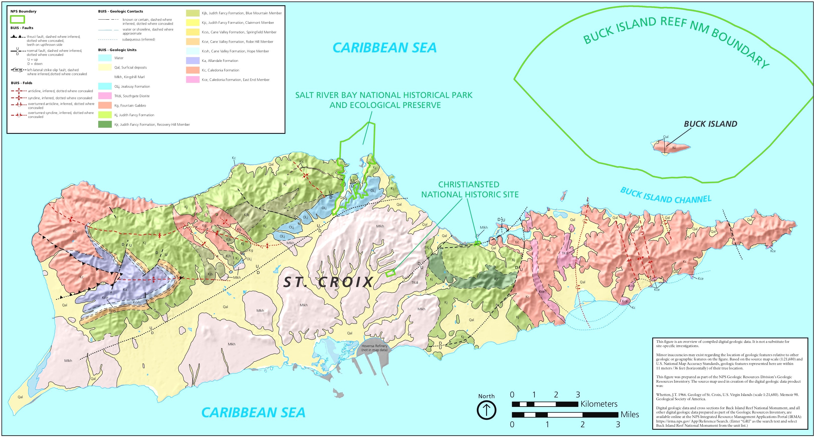
St Croix geological map and physiographic provinces
This map is from the US Geological Society and details all the geological features of St Croix. Click on the map for the full sized version.
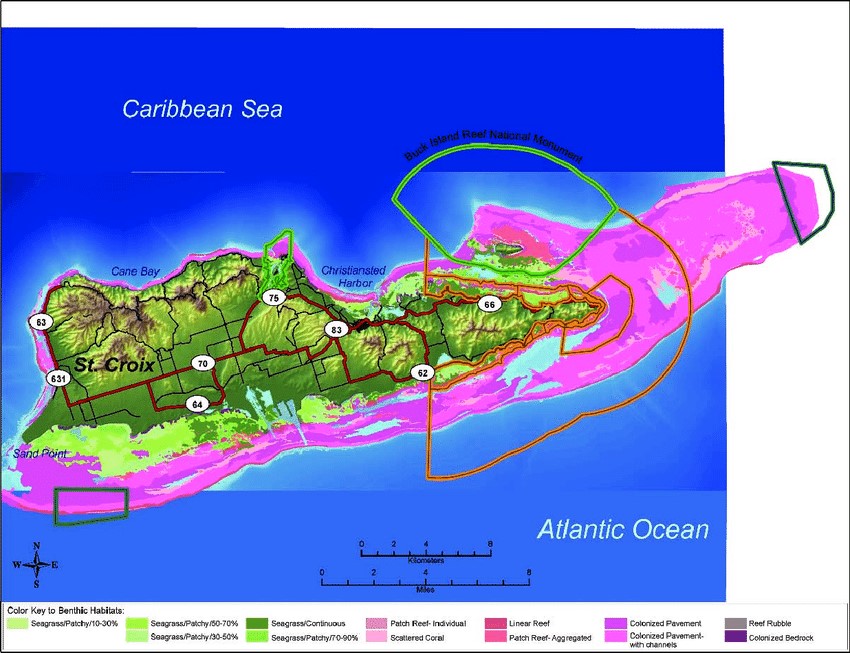
Map of coral reefs of St Croix
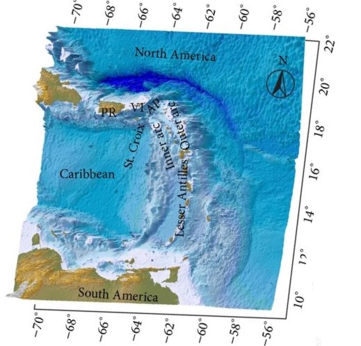
3D Bathymetric map of St Croix
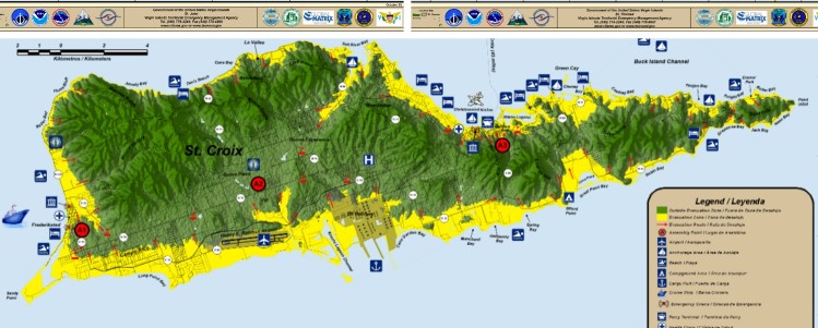
St Croix tsunami evacuation Map
This is a map showing the safes zones and evacuation routes in the event of a tsunami in St Croix:
National Geographic map of St Croix
This map is from National Geographic:
Map of St Croix watershed
An interesting map showing the watershed in St Croix. Shows when it rains, which way the water flows on the island.
An interesting map showing the watershed in St Croix. Shows when it rains, which way the water flows on the island.
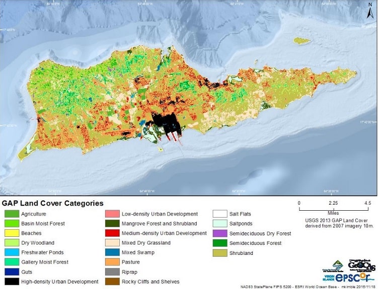
Landcover map of St Croix island
Here is an interesting map of landcover which was part of a Virgin Islands government study on animals. Very interesting to see which parts of the island has zones protecting wildlife.
Historical St Croix maps
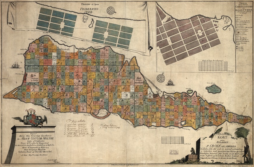
One of the most famous old maps of St Croix is the one made in 1767 by Danish cartographer I.M. Beck, here below, showing the various land parcels as owned back then. Consequently, many people have this map professionally printed and framed for their office or home. It may be the most famous St Croix map available.
Here’s a link if you’d like to buy a copy online: historical map of St Croix US Virgin Islands.
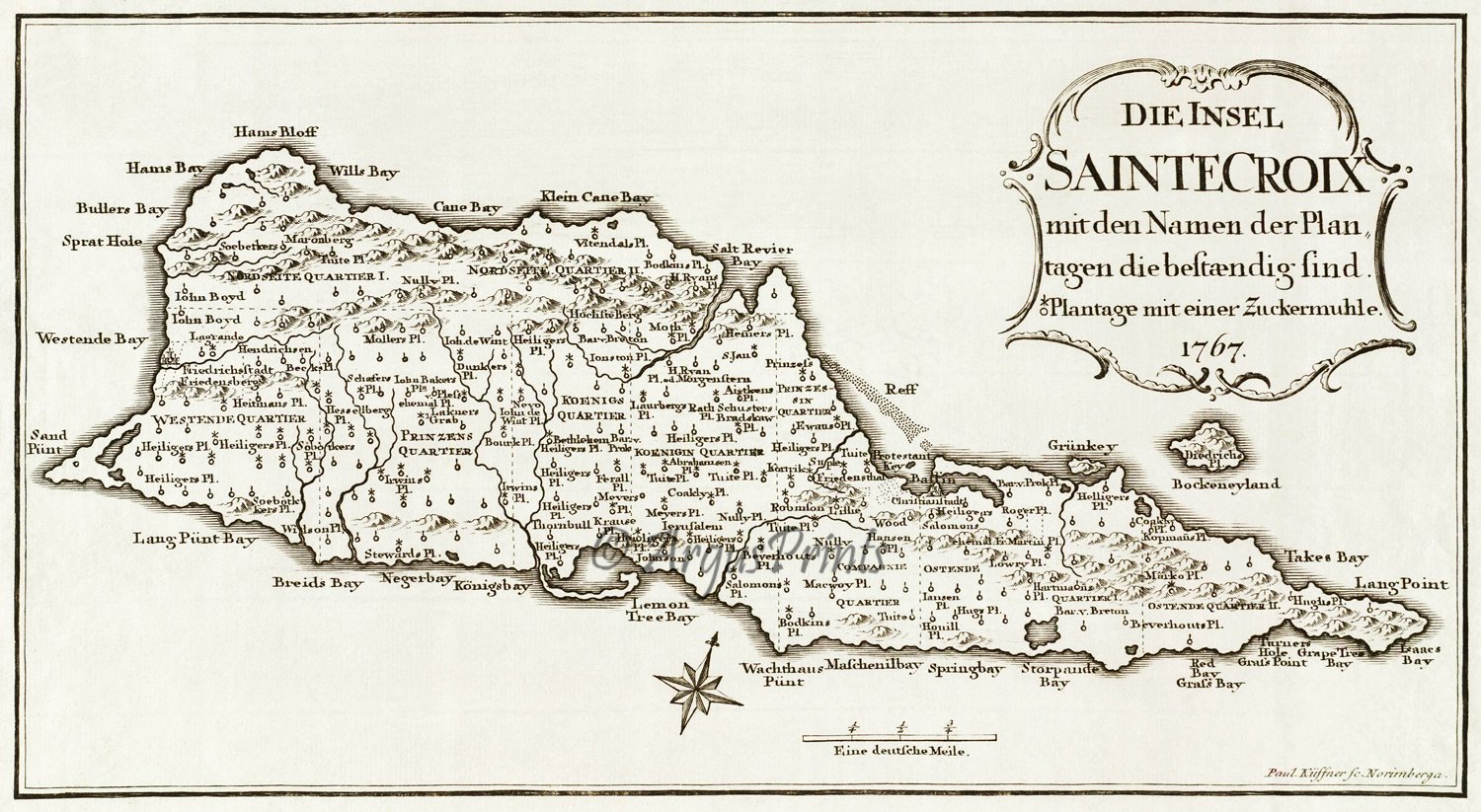
Here is another old St Croix map, this one by Kussner and also from 1767.
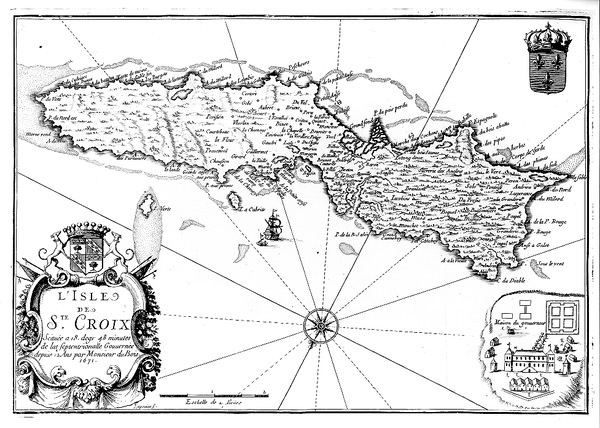
Here is a 1691 French map of St Croix island, which is really distorted. The East End of the island here is as wide as the West End.
Wall art maps
St Croix maps make lovely framed wall art. You can either buy on island, or order online. Here are some of our favorites:
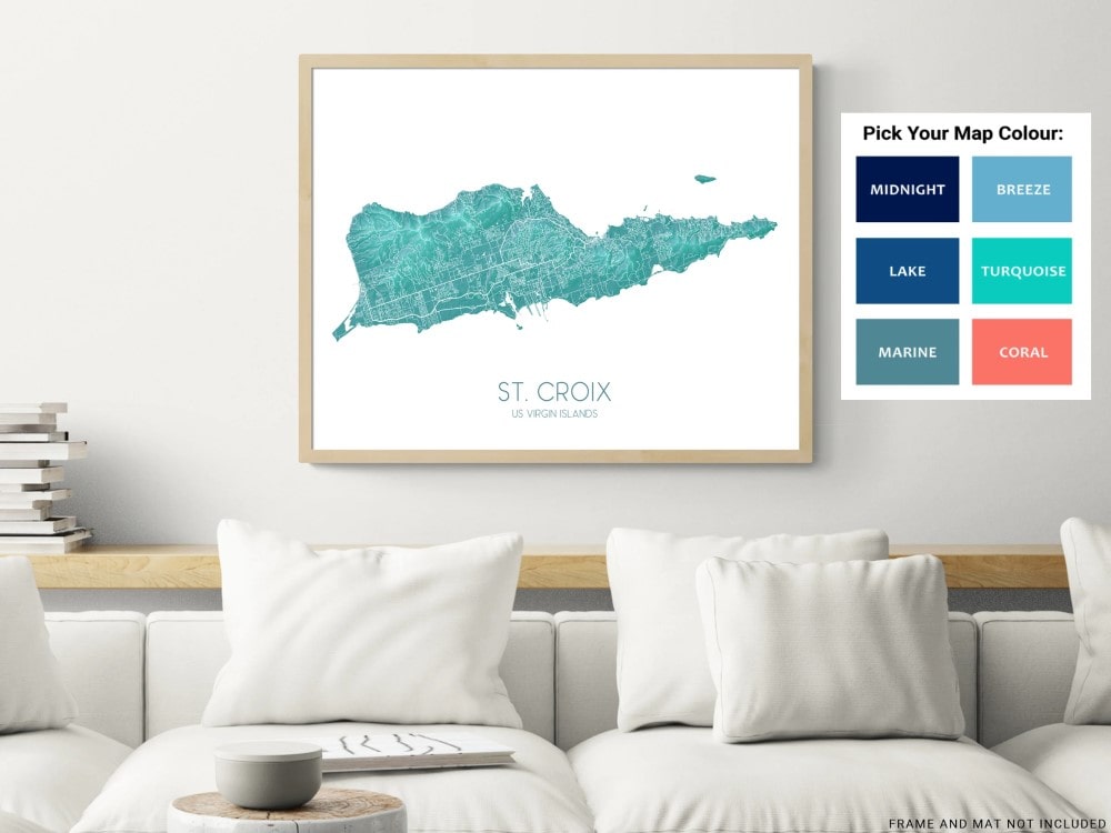
St Croix Map Wall Art Print Poster in Turquoise
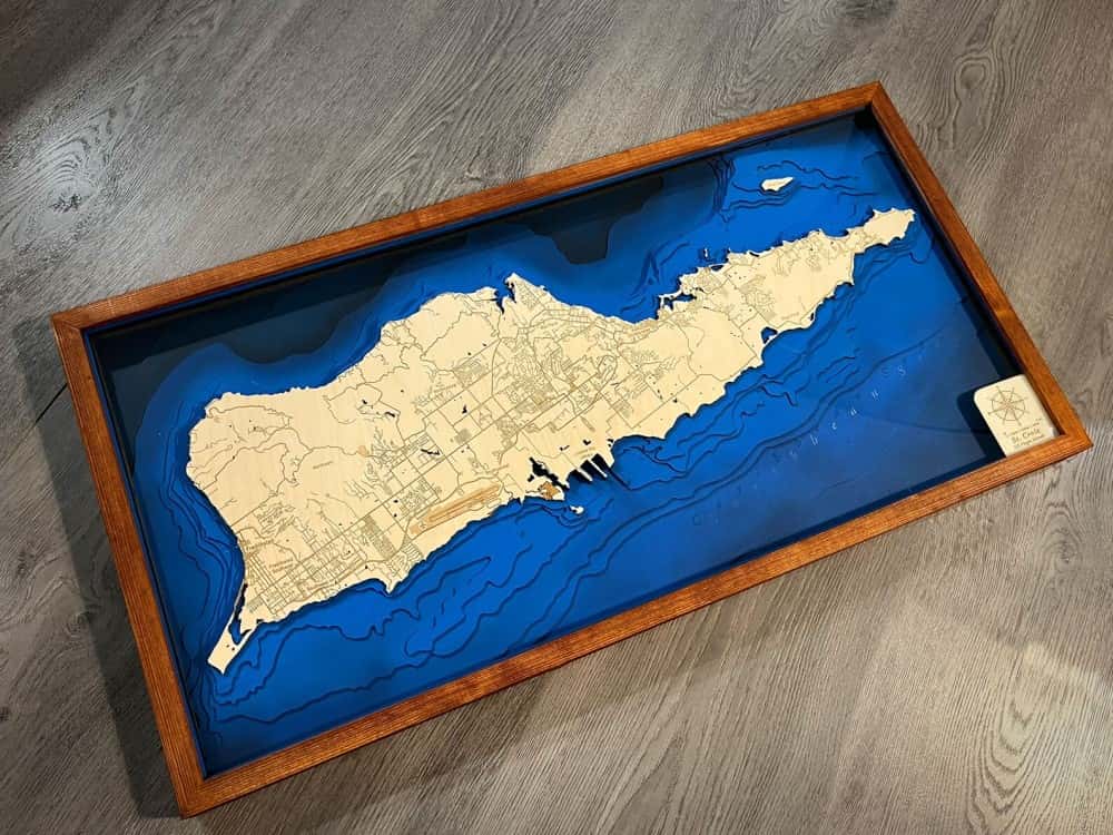
Wooden Frame Wall Map:
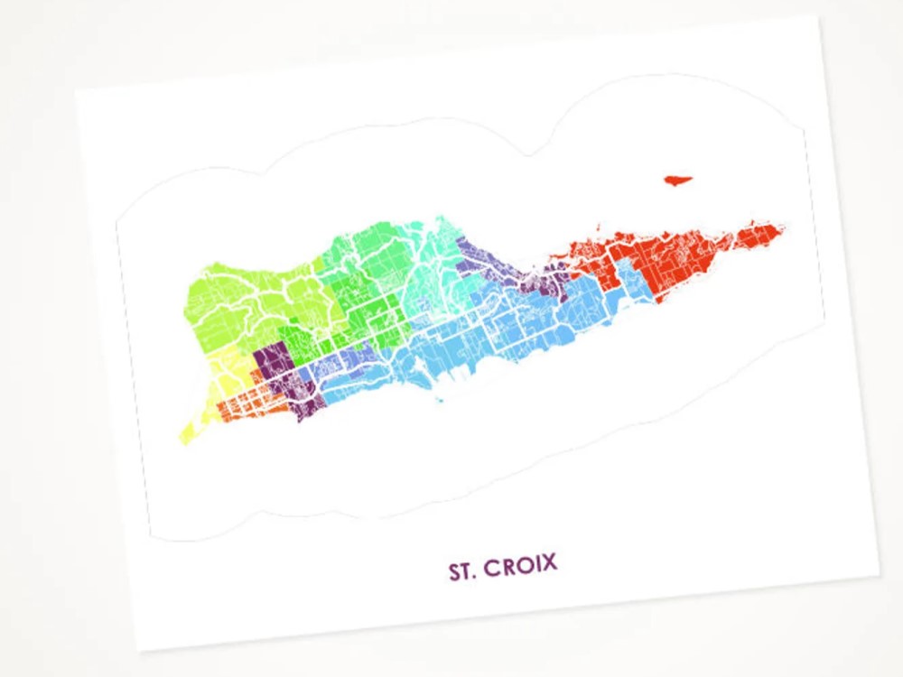
Colorful Wall Art Poster of St Croix Island
For all you geology fans, here’s an amazing map showing all the geological features of different parts of St Croix island.
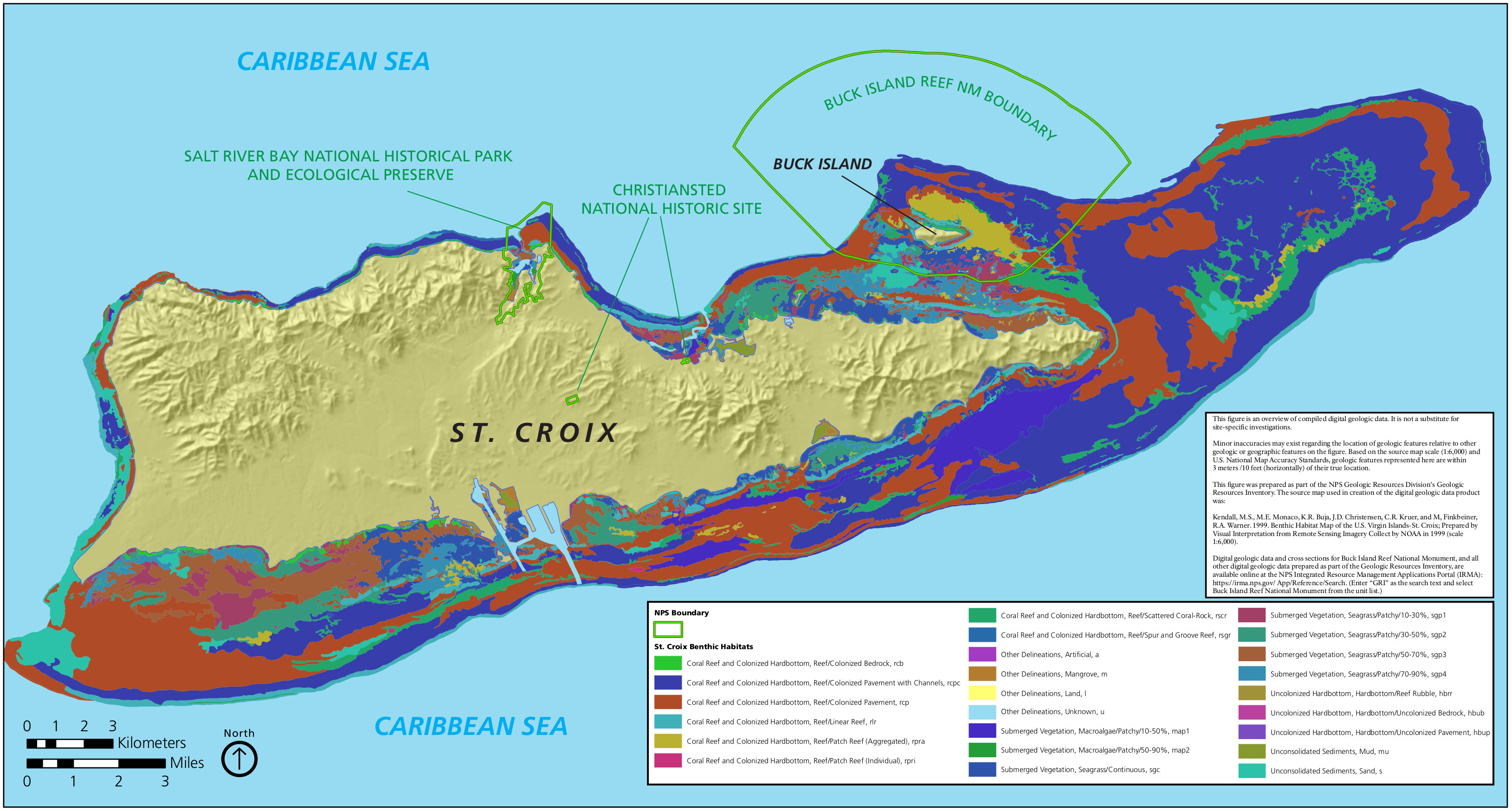
For boaters and underwater marine people, here is a good benthic map of St Croix island showing the physical features of the shallow bottom features. Crucially, it will help you learn about our St Croix coral reefs, and key vegetation such as mangroves and seagrasses.
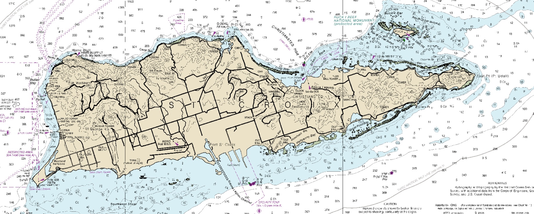
And for all you sailors out there, here is a nautical map of St Croix. You can get the full map version downloaded from the Office of Coast Survey of the National Oceanic and Atmospheric Administration.
And finally, a map made out of gold foil in the outline of St Croix island.
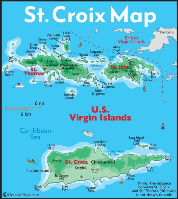
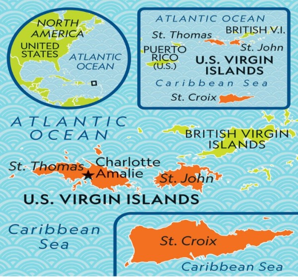
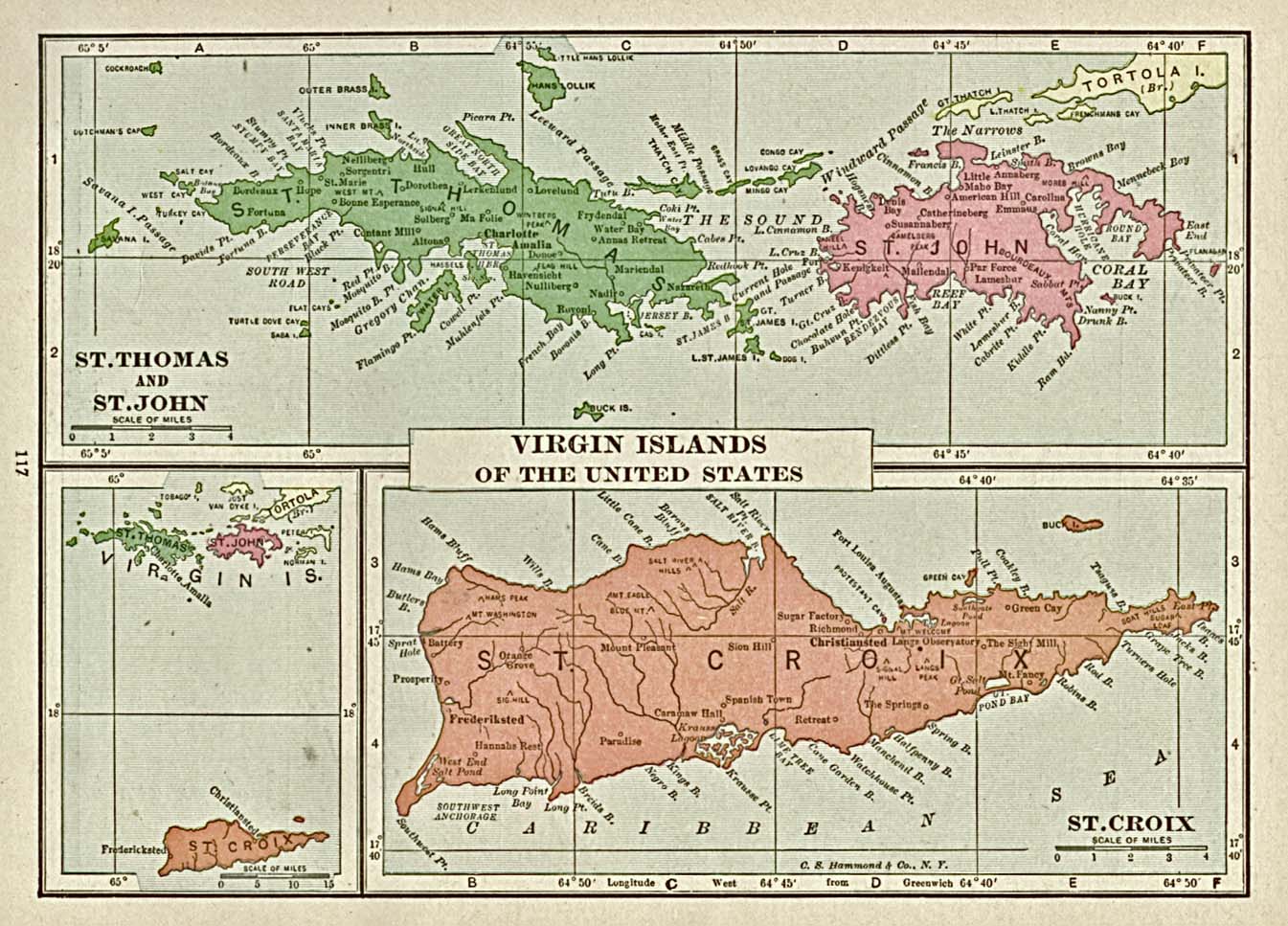
US Virgin Islands map
Here is an old historic map of the US Virgin Islands dating back a century:
And here is a map of St Thomas US Virgin Islands:
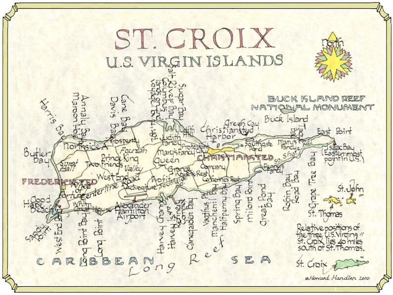
Here’s a whimsical new map of St Croix from 2010 by Howard Handlen. It makes for a beautiful reprint to hang on your wall at home or in the office.
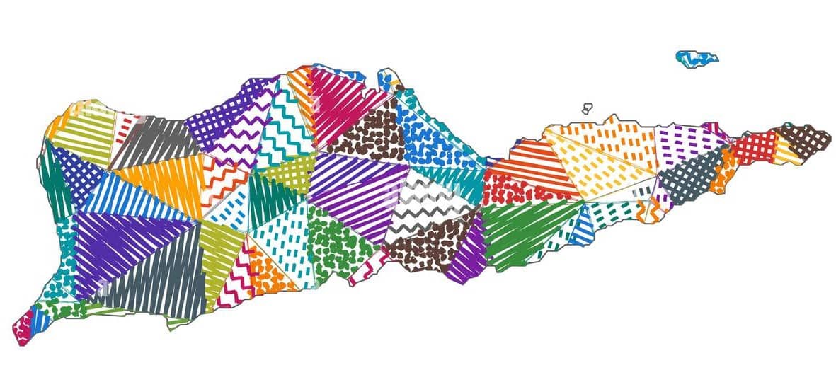
And here’s a fun colorful map of St Croix:
Map of St John in the US Virgin Islands.
How this St Croix map guide is maintained
We live on St Croix and update this page as roads, access points, and visitor resources change. We prioritize practical navigation and visitor safety over promotions.
- Update cadence: reviewed monthly and refreshed as needed.
- What we verify: road access, beach access points, and major landmarks visitors use.
- What we avoid: unverified shortcuts or routes that rely on private roads.
Primary reference sources:
- USVI tourism resources
- National Park Service (Buck Island Reef)
- Google Maps and OpenStreetMap (for navigation context)
Map FAQs
Use the “Printable St. Croix road map (PDF)” section on this page to download a print-friendly copy you can save to your phone or print as a backup.
Yes. Google Maps usually works well on St Croix, but mobile signal can drop in spots. Download an offline map before you arrive so navigation still works without data.
Most drives are under an hour. Christiansted to Frederiksted is commonly about 30 to 45 minutes depending on traffic and road conditions.
Cruise ships typically dock in Frederiksted. Use the map to plan a loop that ends near the pier and leave buffer time to get back before all-aboard.
Christiansted (east) and Frederiksted (west). Most visitor routes are planned around these two towns plus the north shore beaches.
Download the printable PDF map and also save an offline map on your phone. That gives you both a printed reference and turn-by-turn navigation even if signal drops.
Videos