Map of St. Croix for Visitors in 2024
Every tourist needs a map of St Croix island. So we made the best collection of St. Croix maps to help you plan and get the most out of your 2024 holiday at Villa Margarita.
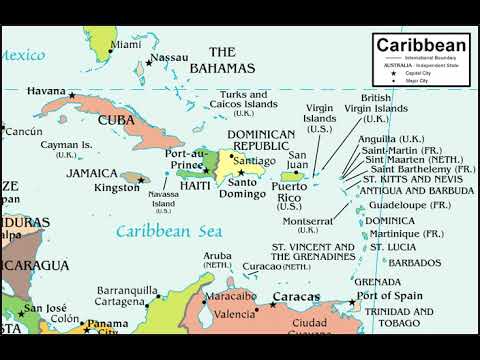
First let’s start with a map of Saint Croix in the Caribbean:
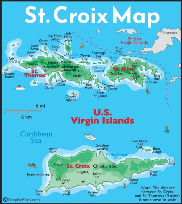

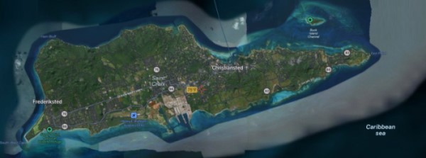
Below is a view of St Croix as seen from from Google Maps. From this map of Saint Croix island you can see the hilly terrain, lush green areas, and plenty of locations where beach meets beautiful turquoise water. One thing we absolutely love about our island is that has not been over-built like so many islands have. There’s nothing like looking out our villa windows and seeing lush, green, undeveloped hills instead of plastered with chock-a-block concrete slabs of apartments and condos. In that sense, St. Croix is truly a undiscovered gem and rarity! You’ll see much of the same views that Columbus did when he landed 500 years ago, which is pretty amazing. Read more about Columbus and St. Croix here (pdf)

Printable map of St Croix
Next comes a printable map of St. Croix. If you didn’t pick one up one up at the airport when you arrive, you can print the map below. It can be pretty handy to getting around the island, though these days Google Maps on your phone is even better.
PS. Bookmark this page: you may need this map if you get lost 🙂 The map is regularly updated so it should be good for 2024.

Click here to download the printable map of St. Croix USVI
Tourist map of St Croix
We recommend downloading the printable map above. It also serves as a great tourist map of St. Croix USVI.
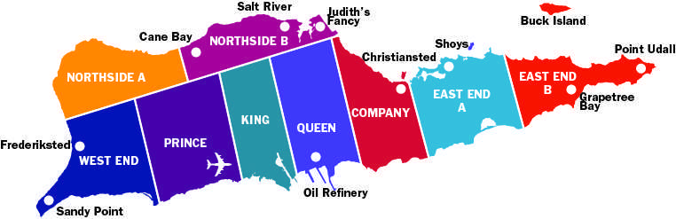
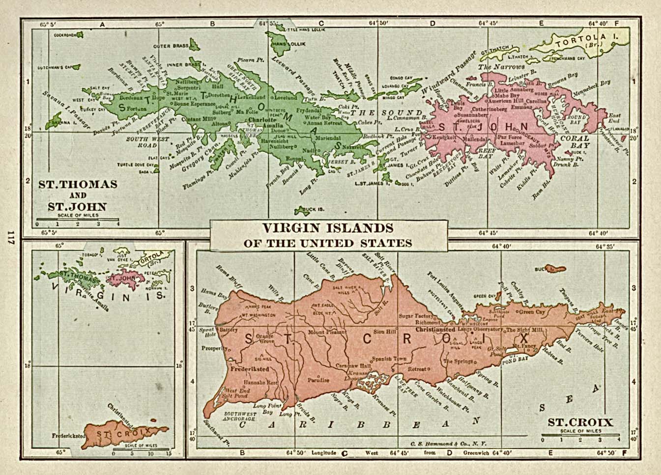
St Croix island is divided in to various districts called quarters. Consequently, learning these quarters is useful especially in particular when dealing in St Croix real estate. Below is a Saint Croix map outline showing the various names of these districts:
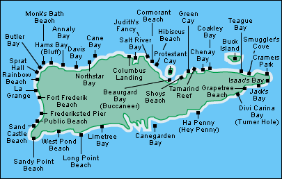
Of course, any self-respecting collection needs a map of St Croix beaches. Actually there are so many beaches on the island that our guests ask for this map to guide them to the best beaches. Conveniently, below you’ll find the location of great beaches on the island:
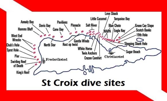
And for all you scuba divers out there, here is a map of St Croix scuba dive sites. As you can see, many of the best dive sites are right off the shore from Villa Margarita or within a 10-15 minute boat ride. For regular Villa Margarita guests, we offer FREE storage facilities for all your scuba gear, so you can travel light and not get hammered with excess baggage charges by the airlines 🙂

Here’s a nice satellite map of St. Croix from Satellite.pro:
Video Map of St. Croix

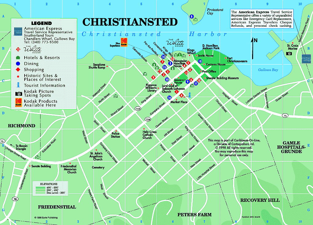
Map of Christiansted
Here is a detailed map of Christiansted on St Croix island. Here you can see popular attractions like
- Christiansted boardwalk — read about Christiansted (pdf)
- St Croix seaplane area
- Fort Christiansvaern — read about Fort Christianvaern (pdf)
- Government House St Croix — read about Christiansted historical areas (pdf)
- Hotel on the Cay
- Christiansted harbor
- D. Hamilton Jackson Park
- Caravelle Arcade and Casino
- Scale House
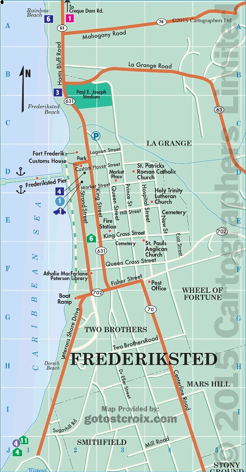
Map of Frederiksted
Here is a map of Fredericksted on St Croix island. Be sure to drop by Rhythms on Rainbow Beach for a killer drink called Cruzan Confusion! 😉
Places of interest include:
- Rhythms on Rainbow Beach — View menu (pdf)
- Frederiksted Pier — read about the pier (pdf)
- Fort Frederik — read about the the fort (pdf)
- Strand Street
- St. Patrick’s Catholic Church
- Custom’s House
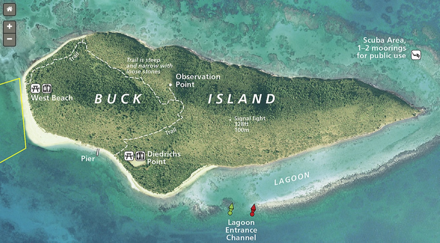
Map of Buck Island in St. Croix
Buck Island St. Croix should be on every St. Croix visitor’s bucket list for 2024. It’s a protected natural park sanctuary, offering one of the purest natural beach experiences you will find anywhere. Conveniently, you can access the full map of Buck Island in St Croix here , provided by the National Park Services website. In addition, there is also an amazing underwater trail for snorkeling, plus Turtle Beach on Buck Island is one of the most pristine beaches you’ll find anywhere. Read more about Buck Island St Croix here (pdf).
Boat access is restricted and a number of licensed companies provide day trips to and from the island. It’s a beautiful 15-20 minute ride over to the island.
Good Web Resources for Map of St Croix Virgin Islands
Here are some of our favorite (and free) resources on the web for finding good maps of our favorite island. Many are satellite based, and some resources even allow you to build your own St Croix maps with just a little effort.
GPS Visualizer: create your custom St Croix map
OpenHistoricalMap: shows a time-based map of the Virgin Islands
WikiMapia: an open-source St. Croix map
MapQuest: a good map of St Croix services available in the the US Virgin Island
ACME Mapper: build your own map of Saint Croix here
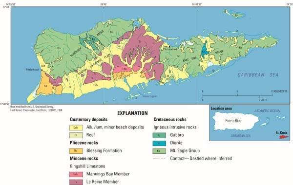
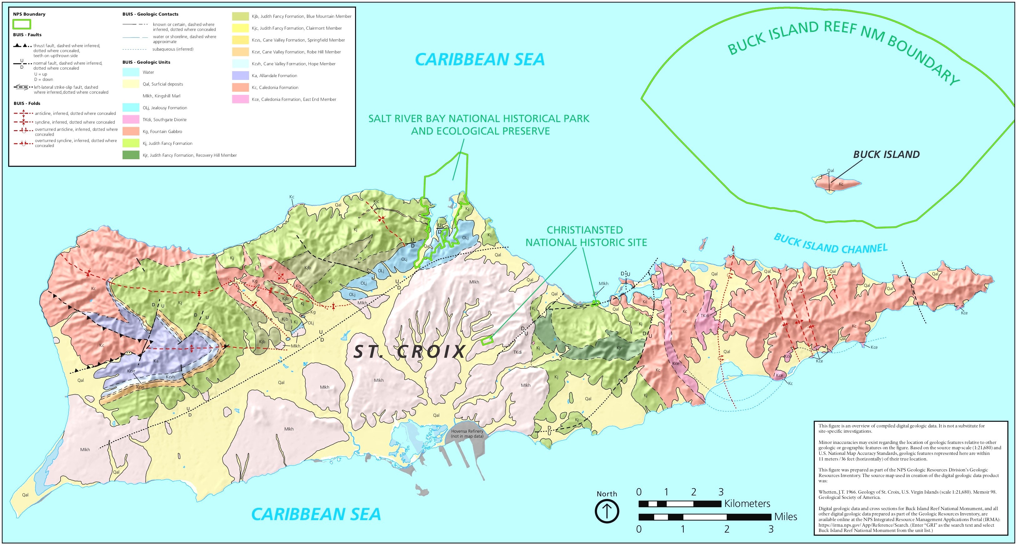
St. Croix geological map and physiographic provinces
This map is from the US Geological Society and details all the geological features of St. Croix. Click on the map for the full sized version.
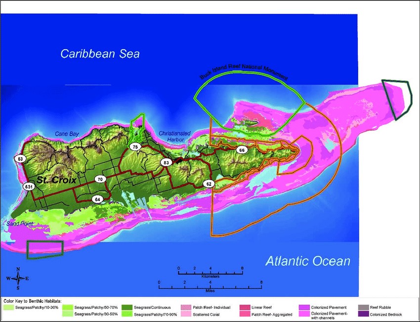
Map of Coral Reefs of St. Croix
3D St. Croix Fishing Map
We think this is a really cool map, showing fishing areas around Saint Croix island in 3D. Note how it even looks like a fish is biting the right side of the island! BTW, here are some good St. Croix fishing charters if you want to try your luck! Prices here (pdf)
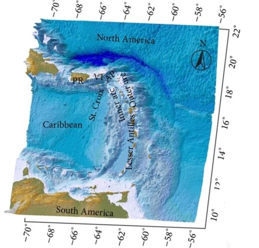
3D Bathymetric Map of St. Croix ISVI
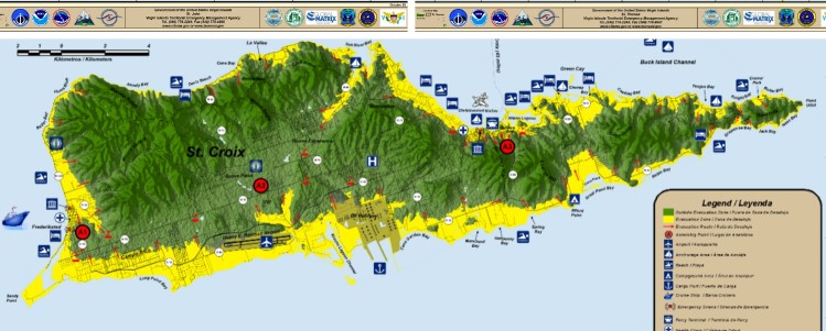
St. Croix Tsunami Evacuation Map
This is a map showing the safes zones and evacuation routes in the event of a tsunami in St. Croix in 2024, well, because you never know:
National Geographic map of St. Croix
This map is from our friends over at National Geographic:
Map of St Croix watershed
An interesting map showing the watershed in St. Croix. Shows when it rains, which way the water flows on the island. Weather patterns in 2024 so far have been pretty dry.
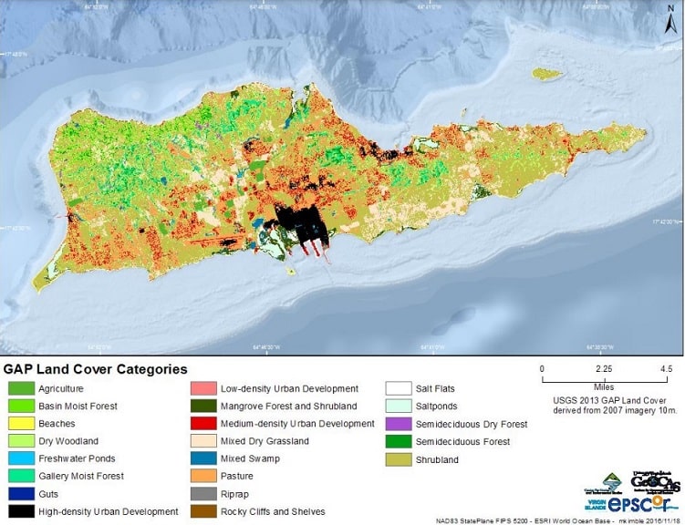
Landcover Map of St. Croix island
Here is an interesting map of landcover which was part of a Virgin Islands government study on animals. Very interesting to see which parts of the island has zones protecting St. Croix wildlife. Read more about St. Croix wildlife (pdf).
Historical St Croix maps
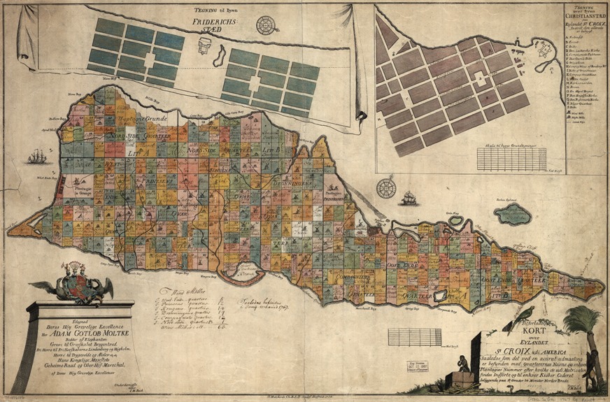
In 2024 you may not realize that back in the old days, people really did have to spent a lot of time making maps in the pre-computer days. It often took years assembling these fabulous historical maps. One of the most famous old maps of St Croix is the one made in 1767 by Danish cartographer I.M. Beck, here below, showing the various land parcels as owned back then. It’s so fascinating that here is the link to the full 15 megabyte file. Consequently, many people have this map professionally printed and framed for their office or home. It may be the most famous St. Croix map available!
Here’s a link if you’d like to buy a copy online: historical map of St Croix US Virgin Islands.
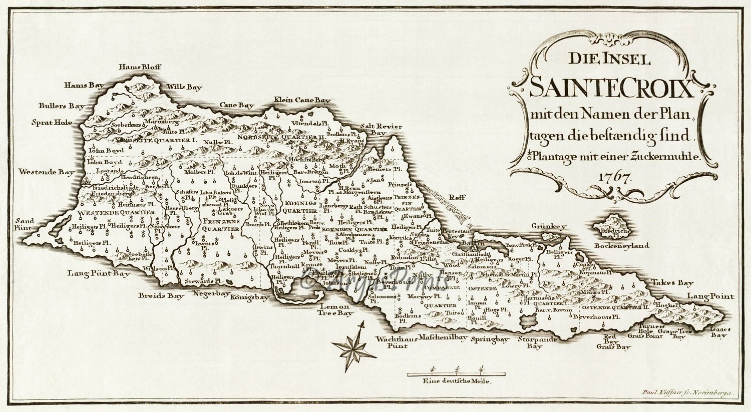
Here is another old St Croix map, this one by Kussner and strangely enough also from 1767….must have been a popular for making maps! You can get the full-sized map here. And it pretty much looks the same as of February 2024.
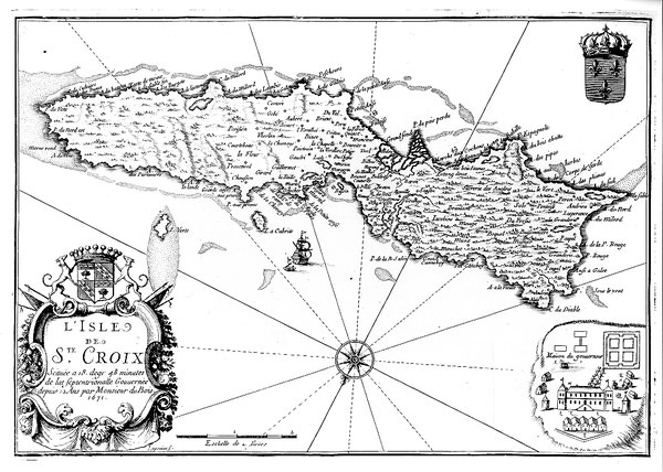
Here is a 1691 French map of St Croix island, which is really distorted. The East End of the island here is as wide as the West End!
Wall art maps
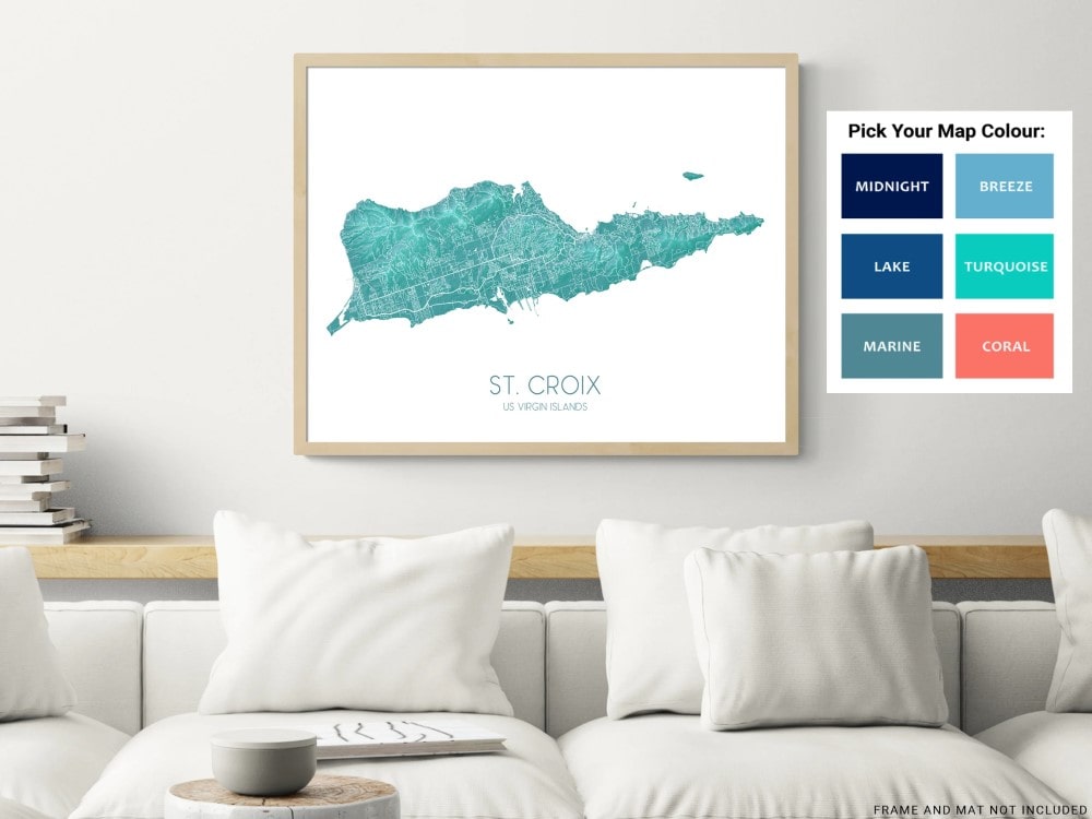
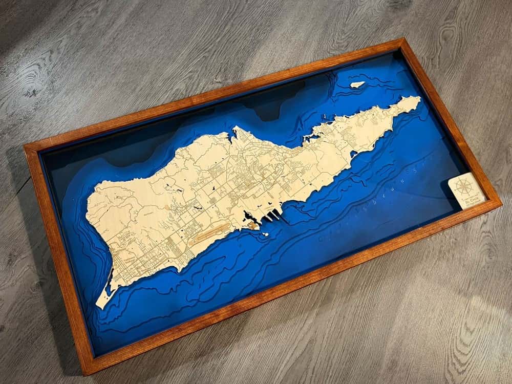
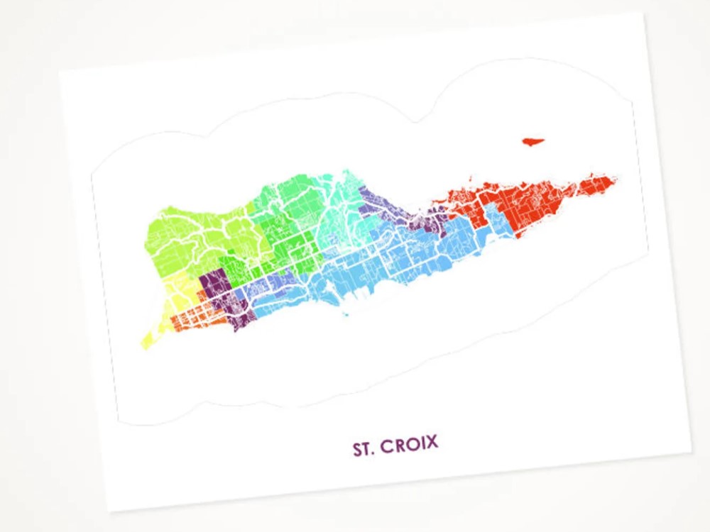
St. Croix maps make lovely framed wall art. You can either buy on island, or order online. Here are some of our favorites:
St Croix Map Wall Art Print Poster in Turquoise: cost about $20 here.
Wooden Frame Wall Map: costs about $200 here
Colorful Wall Art Poster of St. Croix Island: cost about $30 here
For all you geology fans, here’s an amazing map showing all the geological features of different parts of St. Croix island.
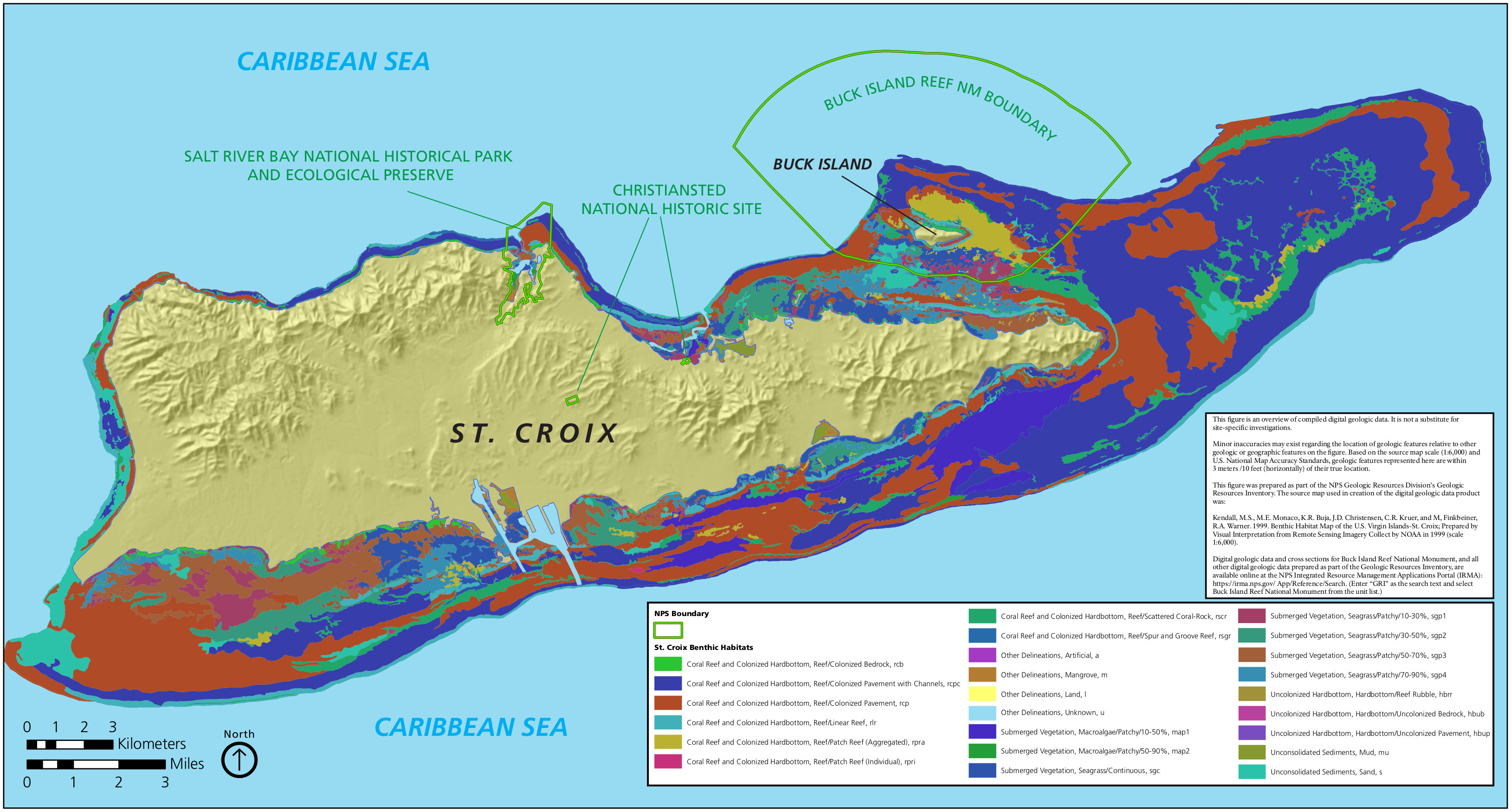
For boaters and underwater marine people, here is a good benthic map of St. Croix island showing the physical features of the shallow bottom features. Crucially, it will help you learn about our St Croix coral reefs, and key vegetation such as mangroves and seagrasses.
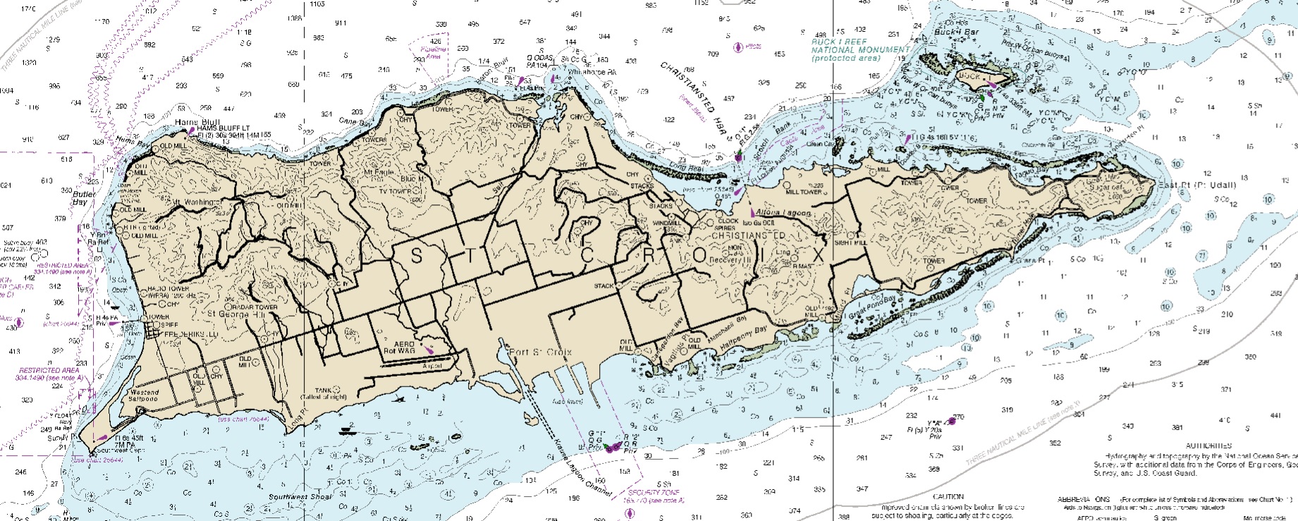
And for all you sailors out there, here is a nautical map of St. Croix. You can get the full map version downloaded here from the Office of Coast Survey of the National Oceanic and Atmospheric Administration and here.
And finally, a map made out of gold foil in the outline of St. Croix island.
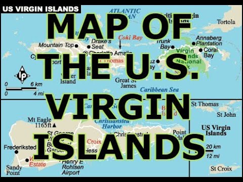
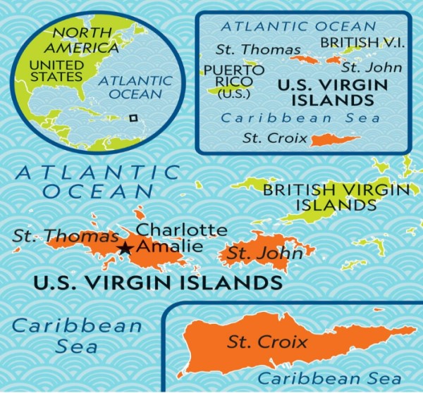
US Virgin Islands Map
Here is an old historic map of the US Virgin Islands dating back a century:
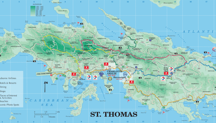
And here is a map of St Thomas US Virgin Islands:
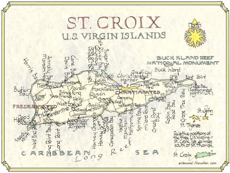
Here’s a whimsical new map of St. Croix from 2010 by Howard Handlen. It makes for a beautiful reprint to hang on your wall at home or in the office.
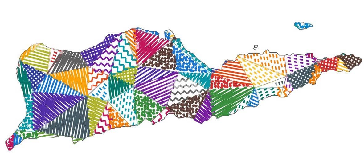
And here’s a fun colorful map of St. Croix:
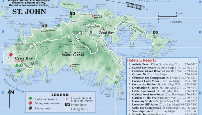
And last but not least, we will conclude our collection of Virgin Island maps with a map of St John US Virgin Islands:
St. Croix Map Caribbean FAQs
The north shore is considered the nicest part of St. Croix due to its central location providing convenient access to the whole island. The north shore features exceptional diving, including the famous “The Wall” (a 14,000-ft drop), great beaches, and a full suite of dining and recreation options.
St. Croix is known for its stunning sandy beaches, world-class scuba diving, watersports, great dining, golf courses, and passport-free travel for US citizens.
St. Croix belongs to the Unites States. Over its history it has belonged to 7 nations, including the Dutch, English, French, Spanish, Knights of Malta, Danish, and the US.
January to April are the best months to visit St. Croix because the weather is a perfect 84°F, always sunny with low humidity and no sargassum seaweed.
You should have a map of St. Croix if you are planning to visit this Caribbean island. It will help you get around as well as learn the historical, cultural and entertainment sites.
You can pick up a free map on arrival at the airport, curtesy of GoToStCroix. The map shows all roads in detail as well as local attractions, bars, restaurants, and hotels.
Google Maps works well in St. Croix and is a great way to navigate roads which often are poorly marked. You’ll need a smartphone with a data connection, or you can download an offline map of St. Croix before you travel.
Here you can download our printable map of St Croix USVI in pdf.
The best map for tourists in St. Croix USVI is the foldable map by GoToStCroix which you can usually find at the STX airport. And its free! it shows all the roads, main attractions and cultural sites, plus many top restaurants, bars and shopping venues.
Explore our enchanting island paradise in 2024 with your St Croix map!
check out the Best Beaches in St Croix
learn about St Croix airport
Bungalows on the Bay St. Croix
Villa Madeleine St Croix for sale
Follow us on social media: